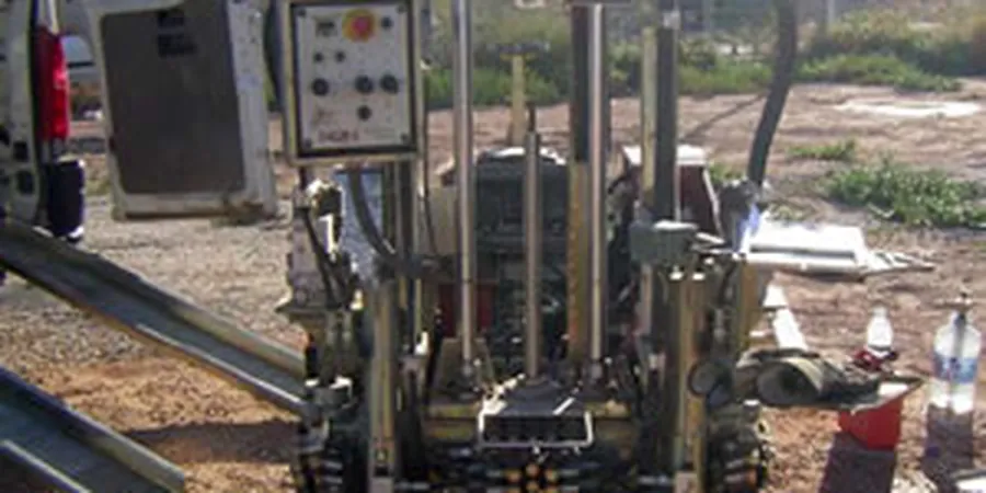
Limerick’s development from a Viking settlement on King’s Island to a modern urban centre expanding across the Shannon floodplain has left a distinct geotechnical fingerprint. The medieval core rests on soft alluvial silts and organic clays, while the southern suburbs climb onto Carboniferous limestone with a patchy mantle of glacial till. Every new bridge approach, quay wall rehabilitation, or campus extension at the University of Limerick presses against these transitions. A standard borehole log will tell you what was recovered at discrete intervals, but it will not show the continuous shift in tip resistance and sleeve friction that separates a marginally stable silt from a fully consolidated clay lens. For that continuous profile, the CPT (Cone Penetration Test) is the tool the laboratory team deploys most often on the Shannon corridor, where pore pressure dissipation tests also help assess consolidation rates in the estuarine clays that underlie much of the city centre. When the stratigraphy is as layered as the soils beneath Limerick, the difference between a design assumption and a construction problem often hides in a 200 mm band that only a cone can read.
In Limerick’s tidal alluvium, a 200 mm silt lens missed by SPT can shift pile set prediction by metres — the CPT’s continuous 20 mm log catches what discrete sampling cannot.