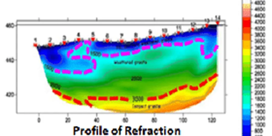
A common mistake in Limerick is assuming bedrock depth is uniform. A 2022 commercial development near the Dock Road was redesigned after encountering a buried channel of the River Shannon at 22 meters — the preliminary desk study had suggested competent limestone at six. Seismic tomography eliminates this guesswork. Our refraction surveys map the overburden-bedrock interface across the city's complex Carboniferous formations, while reflection profiling resolves deeper structures down to 80 meters. The data feeds directly into foundation design and excavation monitoring programs, reducing the risk of change orders when karst features or alluvial pockets appear mid-construction.
A seismic refraction line costs a fraction of a blind overburden excavation and delivers a continuous velocity profile that no number of trial pits can match.